Where We Live
Northcliffe in a nutshell...
Northcliffe in a Nutshell
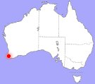
Northcliffe, in the South West of Western Australia (map), has a population of around 770 (census data). The town is the gateway to the extensive and unspoilt coastline of D'Entrecasteaux National Park and enjoys magnificent karri, marri and jarrah forest on its doorstep (environment).
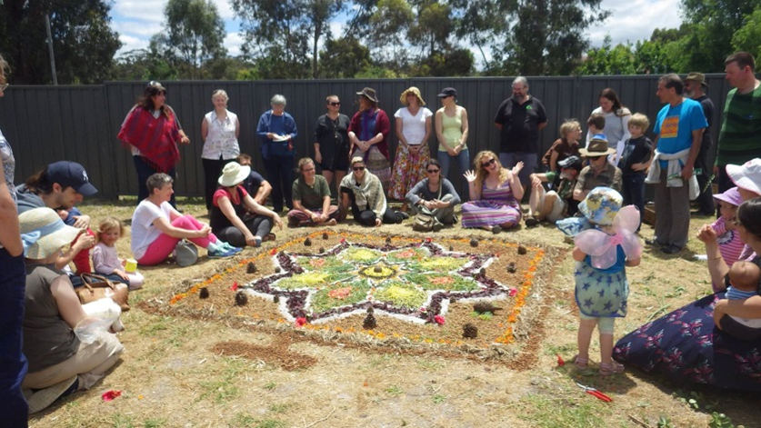
The active lifestyles of our residents can make Northcliffe a busy place on some days. Northcliffe residents support numerous community groups and projects and are passionate about local issues.
Contributing to the lively atmosphere are daily TransWA bus services, the regular flow of Bibbulmun Track walkers, Munda Biddi bike riders, fishermen and 4 wheel drivers travelling toward Windy Harbour, campers, sight-seeing tourists, visitors to Understory art and nature trail, orchid and wildflower spotters, and the farmers, delivery trucks, logging vehicles and others servicing our local industries.
Our Location
Northcliffe is 345km south of Perth by road, in the Shire of Manjimup. Just 18km from the coast, our town is in the heart of The Southern Forests region, defined by the karri and marri forest and jarrah woodlands which surround the town. Some useful distances:
- Pemberton 30km
- The Southern Ocean 18km
- Windy Harbour 25km
- Manjimup 60km
- Bunbury 184km
- Albany 216km
- Perth 345km
A pdf township map (slightly dated)
The Creative Town...
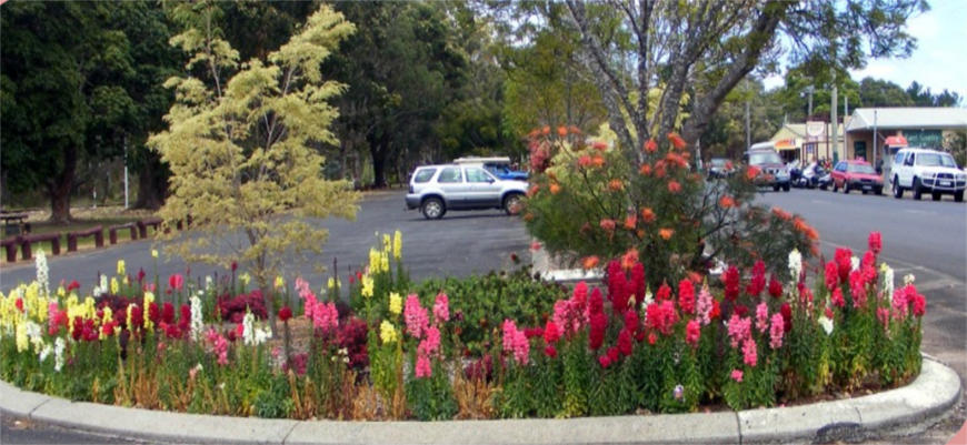
Northcliffe has been a minor mecca for artists since the mid 1970s. Both artists of strong public significance, Howard Taylor AM moved to Northcliffe in 1975 and Guy Grey Smith AM moved to nearby Pemberton in 1974. When you live in Northcliffe it isn't hard to understand why. Northcliffe is now the home to a nationally unique art and nature trail, Understory, and is home and inspiration for a number of artists of significance. We have a local arts organisation, Southern Forest Arts. Artist Tony Windberg offers private art classes operating out of the Windmill Gallery. Textiles and many other arts workshops are a reliable features on the Northcliffe calendar. Visit our art and artists page for more information.
Northcliffe Services
Northcliffe has many services to meet everyday needs including a K to 10 school, nursing post, general store, post office and library. While some residents manage to survive on Northcliffe produce, supplies and services without leaving Northcliffe, most of us make occassional journeys to Pemberton, Manjimup, Bunbury and Perth. Both Pemberton and Northcliffe have have hospital emergency services and supermarkets. Manjimup has a full range of services including dentists, optometerists, rural and machinery suppliers, and many retail opportunities.
A full list of Northcliffe Services and Community Groups is available on this website. We also have a list of all known businesses and retail outlets, and accommodation, food and entertainment listings.
Internet and Phone
Mobile Networks
As well as ordinary phone services, Northcliffe has a Telstra mobile phone tower providing Next-G, 3G and 4G access. There is no Optus or Vodafone network access. To our knowledge, Telstra, Aldi and Boost mobile plans will function in Northcliffe. Telstra and Boost mobile have the widest coverage. Aldi mobile uses the Telstra network however in some remote areas with Teslstra access Aldi mobile does not function. Fortunately Northcliffe is not one of those areas. Our nearest Optus access is the township of Pemberton and the nearest Vodafone access is in Manjimup.
Mobile Phone Hardware
Choice of mobile phone hardware which is compatable in rural areas can sometimes be tricky. If you look for 'blue tick' phones on the Telstra website, these phones have guaranteed compaiability and have been tested to have the best reception at long distances from the tower. However most phones sold in Australia will work, with reduced reception at longer distances. Many people are dissapointed when cheap mobile phones purchased in Fiji or elsewhere don't support Australian rural phone frequencies. The phone needs to support the 850MhZ frequency on 3G. If 850MhZ is only supported on 2G, and other frequencies on 3G you may not be able to use your phone in many parts of rural Australia. This information can be hard to find!
Internet Access
Internet in Northcliffe comes in 4 varieties: ADSL, mobile internet, Satellite internet, and public access internet. We wrote an article in May 2015 exploring the first 3 options however. **However** the Satellite information and the Cellular information in this article is out of date! Addenda to this article:
- ADSL is still your best choice, if your phone line is sufficient quality to get a good speed of connection, and if you are already paying for a landline phone service. ADSL allows for large download allowances which are not available on satellite or mobile internet plans.
- NBN's Sky Muster satellite service is available through a number of providers, with free installation, to all residences in Northcliffe. Installation generally takes 2 to 4 weeks. We wrote an article about this here. For further details and to see the full list of satellite NBN providers (8 at the time of writing) visit the NBN website, enter your address data and follow the directions.
- Telstra Mobile Internet services are available, including via resellers Boost and Aldi.
- If none of the internet options listed in the article suits you then consider using the public access internet at the Northcliffe Community Resource Centre. The NCRC has 12 public access computers as well as 24-7-365 wifi access. Purchase your passes in advance for out-of-hours usage.
To find a list of web pages related to Northcliffe visit our links page.
TV and Radio Reception
The only available television broadcasts in Northcliffe are via a VAST satellite receiver.
Without the use of specialist equipment radio reception in Northcliffe is very limited. The Shire of Manjimup maintains a rebroadcast transmitter in the town centre for the following stations. (Please contact us to correct and update this information - we are not radio listeners!) :
- 102.7 FM Red FM
- 107.5 FM ABC FM National
- 105.9 FM ABC Bunbury
- 630 AM ABC Local (out of Albany)
- 738 AM ABC Local (out of Manjimup)
- 720 AM ABC Perth
- 100.2 ?
History in Northcliffe
Open 7 days per week 10am-3pm, Northcliffe's Pioneer Museum has an outstanding collection of original items used by the Northcliffe Group Settlers more than 80 years ago, illustrating their domestic life and work on the dairy farms, on which the district of Northcliffe was founded.
The original Group 121 bush school, teacher’s cottage and hospital memorabilia bring back countless memories, and the large collection of family photographs is of special interest to those researching their family’s life in the 1920s.
The George Gardner exhibition in the Museum’s mill cottage displays fossils 3000 million years old and 1200 rocks and minerals from around Australia and overseas. The collection also includes the George Gardner photographic record of all native wildflowers growing in the Northcliffe region.
The Robey Engine, brought to Northcliffe in 1924 to help build the timber Group Houses, is on display in a glass case outside the museum.
The Pioneer Museum and Machinery Shed, the electric barbecue and gazebo dedicated to the Northcliffe Pioneer Women are set in the spacious picnic grounds of Jubilee Park. They nestle beside the jarrah and karri Forest Park where several of the original tracks that hauled cut timber to the Northcliffe mill fifty years ago are today’s bushwalking trails, especially beautiful in the wildflower season.
Pioneer Museum Listing on this website
A virtual tour of the pioneer museum (not suitable for mobile devices - uses Flash.
Local History Publications
Local history books are available for purchase at the Visitor Centre or the Pioneer Museum, and some can be accessed at the local library.
Known local history publications are listed below in order of publication date from most recent to oldest.
- 2016 (2nd ed.), After the Burn - Stories, poems and photos shared by the local community, Southern Forest Arts. Responses to the 2015 Northcliffe and Windy Harbour Bushfire. $36. Contact Northcliffe Visitor Centre for purchase.
- Carole Perry, July 2012, Dr West, Northcliffe's Only Doctor, Helvetica, Perth. Obtain locally from the Northcliffe Pioneer Mseum, or by mail from the author, PO Box 377 Northcliffe WA 6262 ($30 plus $10p&p within Australia). carolep@westnet.com.au
- Carole Perry, 2014, Northcliffe, the Town that Refused to Die, Digger Press, Albany. Obtain locally from the Northcliffe Pioneer Mseum, or by mail from the author, PO Box 377 Northcliffe WA 6262 ($30 plus $10p&p within Australia). carolep@westnet.com.au
- Ian and Patricia Crawford, 2003,Contested Country, UWA Press. This hotly contested historical account, including a critique of early white settler culture, covers Northcliffe history up until the logging protests of the 1990s.
- Making the Best of It. A story of local identity George Gardner's childhood narrated to and written by Alison Daubney.
- Follow the Bell. A memoir of cattle grazing in the early 20th century.
- Ron Hitchins, Pemberton Northcliffe Saga.
- I.L.Hunt, Group Settlement Scheme.
- Jack Gabbedy, Group Settlement Scheme, Parts I and II, UWA Press.
- Northcliffe Remembers. Northcliffe Pioneer Museum 1985, into 2nd printing. Available at the Northcliffe Pioneer Museum.
- Northcliffe. I Remember When. Edited by Alison Daubney. Available at the Northcliffe Pioneer Museum.
- Anna Jacobs, The Group Settlers Wife. A fictionalisation by of the life of a young Group Settler family (available direct from the Northcliffe Visitor Centre and also online). This story was commissioned by Southern Forest Arts as part of the written and audio elements of the Understory Art and Nature Experience. If you take the sculpture walk you can choose to listen to a 7-8 minute excerpt from the book narrated.
- Adrian Gunzburg and Jeff Austin, 1997, Rails Through the Bush, Light Railway Research Society of Australia.
Out of Print
- George Gardner, Sites in the Northcliffe Area.
- H.S.Burge, The Northcliffe Experience.
- N.Cooper, Northcliffe Group Settlement Scheme 1924-1934.
- H.S.Burge, Northcliffe and Pemberton – A South West Saga.
- H.D.Evans, Story Behind the Manjimup Northcliffe Railway Line.
- Christopher Berry, The History, Landscape & Heritage of the Warren District, UWA for the National Trust.
- Joseph Cooper, The Past is Always Present.
- Don Symes, I Miss the Hungry Years.
A Short History of Northcliffe in the 20th Century
by Professor Patricia (Trish) Crawford (died April 2009)
coauthor of Contested Country
Northcliffe History, whether predating the European pioneers to the history being made now on the conservation front, has always been interesting and sometimes controversial. It makes for fascinating reading, listening, viewing and experiencing.
The history of the region we now know as Northcliffe was made by Aboriginal people. For over 50,000 years, the Murrum lived in the area, shaping the landscape that the Europeans viewed at first contact.
During the nineteenth century, Europeans mapped and classified the land, its flora and fauna. Pastoralists and drovers brought their cattle into the area. A major change came in the twentieth century when the premier, Sir James Mitchell, secured British and Commonwealth funding to establish groups of settlers on the land of the south-west.
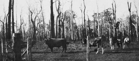 Cattle and ring-barked karri trees on McPherson's block Group 133, 1930's. Photograph courtesy of the Northcliffe Pioneer Museum
Northcliffe, named for the newspaper baron whose papers promoted the scheme, was settled in 1924, one of the last areas selected for this scheme.
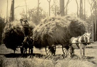 Snowy Adam, Charlie Francis and Ken Sanders senior, carting hay on Group 147 1930's. Photograph courtesy of the Northcliffe Pioneer Museum
Groups of twenty or so families were taken to areas where blocks of 100 to 140 acres had been surveyed, and the men began clearing to establish dairy farms. On most blocks, twenty acres were partially cleared, five intensively. However, the land itself varied greatly; north of Northcliffe, men ringbarked the huge trees to gain pastures; south, their cattle struggled on the 'desolate sand plains' and failed to thrive because there was no knowledge of how to make the soil produce good pastures.
Aboriginal people were marginalised, and few remained in the area. Meanwhile, the government lacked funds, and the Depression meant that the Groupies could not sell their produce at economic rates. Northcliffe, as one of the most isolated of the settlements, was generally regarded as one of the most miserable.
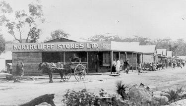 Main Steet 1930. Photograph courtesy of the Northcliffe Pioneer Museum
The next major change came after World War II with the advent of new technology, chiefly the chain-saw. Timber was cut and the land cleared at a rapid rate.
In 1963, Bunnings purchased the Kauri Timber Company mill, and intensified its operations after signing an agreement in 1972 with Japan to sell wood-chips. Some locals opposed Bunnings' clear-felling practices, and their numbers were swelled by the arrival of so-called 'Alternative lifestylers' who moved to Northcliffe from the city. Many were seeking a simpler life in closer harmony with nature; some came from radical political backgrounds.
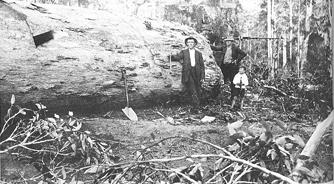 Felled Karri Tree 1925. Photograph courtesy of the Northcliffe Pioneer Museum
In the 1980's, mineral sands explorations provoked further protests, as some locals perceived the benefit of tourism, while others valued the unique ecosystem which made the Northcliffe area one of the richest in Australia for botanical diversity. Bunnings closed their mill in 1995, yet the town defied the prognostications of disaster, and people focused on diversifying the local economy.
By 2000, the town was divided between different groups whose present attitudes have been shaped to some degree by their different histories. Nevertheless, the people of Northcliffe have a strong sense of the past, and act together as a community on a wide range of issues.
Written by Professor Patricia Crawford, University of Western Australia.
Environment and Recreation
Summary
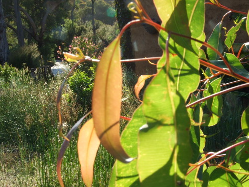
Northcliffe is surrounded by State Forests, National Parks and agricultural land used for dairy farming, bluegums, avocados, olives, wine grapes, beef cattle, blueberries, green tea, black and white truffle farming and more. From Northcliffe to the coast at Windy Harbour is a coastal heath plain, a wild flower wilderness which can be viewed from the top of Mount Chudalup.
A map of Pemberton, Northcliffe and Windy Harbour walk trails can be downloaded here.
Visit Northcliffe, in the South West corner of Australia, to be humbled by massive jarrah and marri and tall graceful karri trees. Take in a view of vast coastal plains populated by granite expanses and islands of vegetation. Peer down from spectacular limestone cliffs and be surrounded by a sea of colour as the wildflowers come out over Spring and Summer.
The National Parks around Northcliffe feature fantastic wildness and biodiversity and offer something for everyone. Local recreation sites for visitors to explore include the Boorara Tree and Lane Poole Falls, Point D'Entrecasteaux, Salmon Beach, Mount Chudalup, Shannon and Windy Harbour.
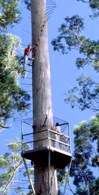
In Northcliffe you can take a scenic drive, walk on popular local walk trails, hike on the world famous Bibbulmun Track, or travel via Mountain Bike along the Munda Biddi Trail, running from Perth to Albany. You can go whale watching, 4 wheel driving, swimming or cast a line into the spectacular Southern Ocean.
Northcliffe Forest Park
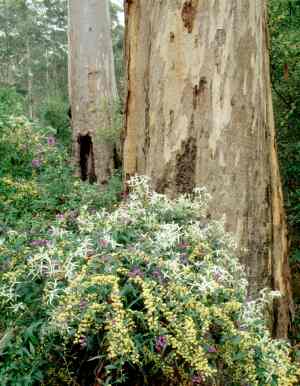
Northcliffe Forest Park was created as a home for conservation and recreation by the hard work of local botanist George Gardner OAM (1912-2005) and Archie Jackson. Since that time it has been managed by the council in partnership with volunteers from Northcliffe. It provides the town with a beautiful cloak of green: High value Karri and Jarrah woodlands surrounding and permeating the townsite.
Forest Park contains walk trails, and a short drive leading through spectacular stands of old growth Karri, Marri and Jarrah trees to the iconic Northcliffe attraction, the Hollow Butt Tree, and a number of picnic spots.
The Karri trees stand up to 75 metres tall and a huge variety of flora and fauna populate the park. There are picnic tables, a toilet, free gas BBQ and shelter at the Hollow Butt, and some facilties at Acacia Picnic Ground.
The Hollow Butt Tree
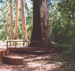
The Hollow Butt is a spectacular large karri Tree which has been burnt out at the base by fire and suffered many other assaults of nature but it is still living. A platform has been built around the base to protect the tree roots (an old Northcliffe photo opportunity used to involve parking your car inside the tree). A free Gas BBQ, picnic shelter and toilet are available. 2 loop walk trails depart from the Hollow Butt, the easy Twin Karri Loop and the challenging Marri Meander. Travel down George Gardner Drive to the Hollow Butt carpark.
D'Entrecasteaux National Park
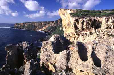
"Gateway to D'Entrecasteaux National Park" is proudly proclaimed on the signs outside Northcliffe. Qualities of remoteness and pristine natural beauty are features of D'Entrecasteaux National Park (pronounced don-truh-cast-oh). The park stretches 130 km along the south coast from Augusta to west of Walpole and covers more than 114 000 ha. Spectacular coastal cliffs, beaches, mobile sand dunes, vast coastal wildflower heaths and even pockets of karri are all part of the scenery. The park has isolated beach camp sites, wild coastal vistas and great fishing. Much of this park is managed for its wilderness values, so few visitor facilities are provided.
Major streams and rivers, including the Warren, Donnelly and Shannon drain through D'Entrecasteaux and empty into its coastal waters. High sand dunes and limestone cliffs on the sea coast give way to coastal heathlands and a series of lakes and swamps further inland.
Visit Point D'Entrecasteaux, Salmon Beach and Mount Chudalup for great walk trails, lookouts and picnic facilities. Park information is available from the Northcliffe Visitor Centre.
Be sure to take the time to explore this spectacular part of the south west. The local accommodation, cafes, businesses and the friendly locals will make sure you have a memorable time and return again.
Warren National Park
Warren National Park covers approximately 3,131 hectares and is a prime example of karri forest with trees reaching heights of a staggering eighty nine metres tall. The Warren River meanders through the park, with gullies and streams joining it throughout the region.
Heartbreak Trail is the main Tourist Drive through the Park. It is a one way, narrow and winding gravel road that does become slippery when wet, so please drive slowly. Along Heartbreak Trail you will find many sites to stop and enjoy the river views with most sites having river lookouts and decks. Heartbreak Trail is not suitable for caravans, camper trailers or coaches.
Drafty's Camp and Warren Camp offer great tent and vehicle based camping opportunities. At Drafty's Camp you will find a camp kitchen with gas cooking facilities. Please leave this facility clean and tidy for the next campers to use.
Also in the Warren NP you will find the Bicentennial Tree recreation site where you can climb ascend to the top of the lookout, have a BBQ or explore the walk trails that link all the sites in the park.
Shannon National Park
Shannon National Park is set in some of the most magnificent karri country in Western Australia's southern forest. The park covers the entire basin of the Shannon River, from its headwaters to the Southern Ocean. The park covers 53,500 hectares, including old growth karri forests and biologically-rich heathlands and wetlands.
Information shelters tell the story of the Shannon, or you can listen on your radio to the park broadcasts at signposted stops around the Great Forest Trees Drive. There are also camping, picnic and walking opportunities within the park.
Shannon was one of the last areas in the South-West to be opened up for logging, due to its inaccessibility. The Shannon area was largely untouched until the 1940s, when an acute shortage of timber after World War Two prompted the State government to establish a timber mill there. Timber cutting began in the Shannon basin in the mid-1940s and the town and timber mill were established in the late 1940s.
The information shelter at Shannon Recreation Area is near the site of the old mill. The town was built across the highway where the camping ground now stands. The settlement was designed for 90 mill houses in a double horseshoe surrounding the area, which eventually included a hall, church, store, post office and nurse station. A dam was built upstream from the mill site in 1949 to ensure summer supplies. The picturesque location meant it also became a popular swimming and marroning place.
After Shannon mill closed, the houses from the old town site were sold and taken away. Today, only traces of the mill town and former forestry settlement can be seen, such as the fruit trees still growing in cleared areas of the Shannon camping ground. You can also see the remains of old buildings and railway lines along the Shannon Dam walk trail. Old logging tramways and roads are now used for walk trails and scenic drives. The area was gazetted as a national park in December 1988.
Beedelup National Park
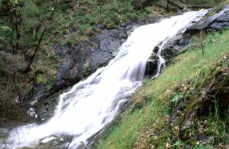
Situated on the Vasse Highway 22km west of Pemberton, Beedelup National Park is mostly Karri Forest with some areas of jarrah and marri. The Park features the popular Beedelup Falls with its suspension bridge, the Walk Through Tree and great forest walk trails.
A series of walk trails lead off from Beedelup Falls and take you to the Walk Trough Tree, Karri Valley Resort and around Lake Beedelup. The Bibbulmun Track also links the site and offers a vehicle access point to walkers.
Beedelup Falls is where the Beedelup Brook flows for 100m over a series of steep granite rocks. The falls are in full flow during winter and spring but can be viewed year-round along the walk trail and boardwalks. There is universal access to a viewing platform overlooking the falls. For the more adventurous there is an upstream bridge with water gushing just centimeters below your feet or the spectacular suspension bridge at the base of the falls.
Pemberton

Pemberton is located amongst some of the areas most beautiful karri forests some 30 kilometres North of Northcliffe. With a population of 5000 and a booming tourism scene, Pemberton is home to fantastic galleries, wineries, marron farms, restaurants, a microbrewery, King Trout and the Pemberton Tramway.
The tramway takes passengers on a round trip journey to the Warren River siding at the Cascades. It runs several times per day, seven days a week.
As well as luxury cabins, hotels and motels the town features backpacker accommodation, a caravan park and campgrounds in natural settings such as the Big Brook Aboretum.
Walpole
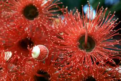
The Red Flowering Gum is our most internationally popular and widespread eucalypt. This Australian native originates in the spectacular Walpole Wilderness Area. The town of Walpole has become associated with the Walpole/Nornalup Valley of the Giants Walk which features other spectacular local species; Huge Red and Yellow Tingle trees. But the true charm of this coastal town is its location on the beautiful Walpole inlet.
Walpole is a popular destination for nature tourism, fishing and beach enthusiasts, and adventurers of all kinds. Many South West visitors travel to Pemberton to visit the Gloucester climbing tree in Pemberton and then travel on to Walpole, Narnalup and the Valley of the Giants Tree Top Walk via Northcliffe.
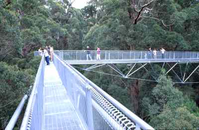
Located 30km East of Walpole, near the small town of Nornalup, the tree top walk is an exhilarating adventure experienced by millions since it opened. Slightly calmer is the Ancient Empires Walk, leaving from the same point and exploring the insides and outsides of fantastically shaped giant Tingle trees.
The Tree Top Walk is open 7 days a week, weather permitting, and is well signposted from highway number one.
Moons Crossing and River Road
Located half way between Northcliffe and Quinninup just off Wheatley Coast Road are the picturesque recreation sites of Moons Crossing and River Road Bridge. Both sites are located on the Warren River and offer excellent places to have a quiet picnic and take in the scenery.
Moons Crossing has BBQ's and tables and has restricted space for tent based camping. River Road Bridge has no facilities but is a great place for wildflowers and bird life. The Bibbulmun Track passes over River Road Bridge and passes within 200m of Moons Crossing.
There is no vehicle access across the river at River Road and 4wd vehicles can cross the ford at Moons Crossing during summer and autumn.
Carey Brook/ Goblin Swamp
Follow the Vasse Highway out of Pemberton towards Nannup for approximately 20km, turn left into Boat Landing Road. Approximately 1.5km along Boat Landing Road, look for Grass Tree Hollow and Snotty Gobble Loop camping sites. Both are accessible by 2wd vehicles.
Here you can enjoy quiet camp sites set among marri and jarrah forest near the crystal clear Carey Brook. There is also a campsite accessible only by foot for those looking for a more secluded experience. There are single vehicle-based camp sites and designated group camping areas.
There is a walk trail that links all the camp sites together and special treat is in stall for those who take the time to discover the Goblin Swamp site.
Fernhook Falls
A small waterfall and rapids with beautiful walk trails and a camping ground. Located some 15-20km off highway number one, between the Northcliffe turnoff and the town of Walpole, the campground features beautiful private sites integrated into the natural environment with the sound of the river running though.
Bibbulmun Track
The Bibbulmun Track is a world class walking trail around 1000km long and stretching from Kalamunda in the North (near Perth, Western Australia) to Albany in the South. There are 48 campsites along the track at intervals from 10km to 24km. These are supplied with purpose built overnight shelters, toilets, rainwater tanks, tables and in some instances fireplaces.
Northcliffe has a special relationship with the Track and is located at the Northern end of the longest wilderness stretch of the track as it passes through D'Entrecacsteaux National Park. Prior to 1988 the route for the Bibbulmun Track finished at Northcliffe at the site of the historic Boorara Tree.
Visit the Friends of the Bibbulmun at www.bibbulmuntrack.org.au for more information and current track conditions.
Cape to Cape Track
If you have survived the Bibbulmun Track then another South-West adventure which might interest you is the Cape to Cape Walk Track. This runs 135km along the Leeuwin-Naturaliste Ridge between the lighthouses of Cape Naturaliste and Cape Leeuwin.
The entire track is a 5-7 day challenge but the trail also offers alternative options to stroll or hike along shorter sections. You can choose to camp out along the Track, or make use of the wide variety of excellent accommodation available in this popular Margaret River holiday region.
For more information visit the website of the Friends of the Cape to Cape Track at www.capetocapetrack.com.au.
Munda Biddi Trail
The Munda Biddi Trail is a nature based off-road cycling experience travelling from Mundaring (near Perth), over a 1000km trail, to Albany. Riders camp in shelters or stay in towns along the route and there are many access points for vehicle drop offs and pick ups.Northcliffe is a 'trail town' and the Northcliffe to Walpole leg is one of the most and remote and beautiful sections of the trail.
Visit the Munda Biddi Trail foundation at www.mundabiddi.org.au for further information.
Short Walks
Short walks through Northcliffe Forest Park are accessible by foot from the township. Other short walks in the region feature the limestone cliffs of Windy Harbour. Local granite monolith Mt Chudalup features one of the most spectacular short walks in the South West of Australia. In Winter and Spring walk to Lane Poole Falls. Try a walktrail at the Shannon National Park or Blackberry Pool to get a real sense of Karri Forest types.
Forest Park Walks
The Marri Meander, The Gardner River Adventure Trail, The Twin Karri Loop, the Bibbulmun Track, the Town Dam Track all thread through Northcliffe Forest Park. The Understory Art and Nature Trail is a paid attraction featuring specially commissioned artworks, and audio tours featuring commissioned poetry, music and stories. The trail takes in a range of the different types of coastal scrub and forest types of the region. In fact all the local walk trails offer an experience reflecting the diversity of the local forest as it responds to soil types and depths, water and nutrients, buried and surface granite deposits and other influences. From the Hollow Butt Picnic Area you can find the entrance to the easy Twin Karri Trail. The Marri Meander leaves from the same point and is a much longer trail through spectacular karri forest. Bardi Creek Trail is part of the Bibbulmun Track and takes walkers from Acacia Picnic Area to the Pioneer Museum in town. The Gardner River Adventure Trail leaving from Acacia picnic ground takes you down to the river, across a log bridge and back to Acacia again. Contact the Northcliffe Visitor Centre for further information.
Mount Chudalup Summit Walk
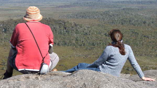
Half way between Northcliffe and Windy Harbour you will find Mount Chudalup rising 188m above the plains to reveal unobstructed views of the fringing karri and jarrah forest merging to heathlands. In ideal conditions, climbers have 30km view over D'Entrecasteaux National Park and the coast. A 1.5km steep walk trail to the summit leads from the carpark. Make sure you have appropriate clothing and footwear and be sure to take some water with you.
Point D'Entrecasteaux Walks
Take the sealed 2wd and large vehicle access up D'Entrecasteaux Drive, running North West from just outside the Windy Harbour Settlement, past Salmon Beach Road and up to a small turning loop and carpark (or you can turn off into the Tookalup carpark). There are several walk trails to choose from:
1. the 2.8km Coastal Survivors Walk down to Windy Harbour (allow 2 hours for a return walk). Trail Classification - Class 3. This coastal walk along the foredunes and cliff tops links Windy Harbour and Point D'Entrecasteaux via Cathedral Rock. Learn about the coastal survivors you will encounter along the way and how they have not only adapted to but thrive in this most demanding of environments.
2. The 1.3km Cliff Top Walk running from Point E'Entrecasteaux to Tookalup. Allow 2 hours for a return walk. Trail Classification - Class 2. Experience the rugged limestone sea cliffs towering above the Southern Ocean. It is a moderately easy walk from Point D'Entrecasteaux to Tookalup.
3. The 400m return Pupalong Loop. This easy walk aims to show how important country is to the Noongar custodians of the South West.
4. Tookalup Lookout is accessible on foot easily from the Tookalup carpark and in accessible toilets, paths and seating make this a suitable attraction for wheelchair users. This is a spectacular whale watching lookout perched on the cliffside and an unforgettable experience at sunset.
For more information on Point D'Entrecasteaux visit Deparment of Parks and Wildlife
Lane Poole Falls Walk
In winter Lane Poole Falls is a fast flowing water fall with an excellent viewing platform at the base. The 5km return walk trail leads off from Boorara Tree and meanders through the dense understory of the forest and is a blaze of colour when the spring wildflowers are in bloom. There is a second lookout with a shelter along the trail to have a rest and listen to the abundant bird life.
Climate and Weather
The towering karri forests within walking distance of town are a product of Northcliffe's good rainfall amongst other factors. Although the recorded amount of rain in the South West has sharply dropped in the past 50 years (and this will impact the karri forests over time), from a lifestyle and farming perspective, rainfall is one of the assets of the Northcliffe locality. In 2014 the Shire of Manjimup was chosen by Washington magazine 'Weatherwise' as one of the ten 'weather paradises' around the world (article). Residents value Northcliffe's mild climate and a local rule of thumb is that the temperature will always be at least 5 degrees cooler than Perth. Northcliffe winters are cold enough your house will require (usually wood fueled) heating.
In this article we have covered the following topics:
Weather
Our current recommended Northcliffe weather website is ozeforecast.. Ozeforecast accesses genuine local measurements from Dept. of Agriculture weather stations. Ozeforecast's digital weather forecasts appear to mirror the BOM Meteye forecasts for Northcliffe.
The most detailed and local weather forecasting information available in our region is the BOM's Meteye service. You can enter the Northcliffe postcode, 6262, to access the information and then click on the map where you live to obtain an even more local forecast. Meteye uses complex computer modelling to provide weather information and forecasts on a 10 x 10km grid of Australia. In 2014 we wrote an article about Meteye.
Slicker weather websites will often be providing Manjimup based weather information and forecasts although they still claim to be Northcliffe forecasts. Some will list Shannon weather station. While this is closer to Northcliffe (25km) than Manjimup (45km) the weather station at Shannon now only provides limited data with the full weather station decommissioned by BOM over ten years ago. While weather information may purport to be from 'the Shannon' you will have to dig deep to find out where they are really using Manjimup data.
Both the Shannon and Manjimup have more inland weather and climate than Northcliffe. Our town is only 18km from the ocean and has afternoon and evening sea breezes and coastal rain effects. Manjimup is 50km from the ocean and the differences between Northcliffe and Manjimup weather can be large!
A Department of Agriculture weather station provides genuinely local measurements of Northcliffe's temperature, rainfall and other relevant info however the information is presented in a fairly raw formats (here). Ozeforecast and some other services republish this weather information in a more friendly format. We wrote an article in 2014 about the Department of Agcriculture's weather station network.
Finally, iphone and Android users, might be interested in the offical Bureau of Meteorology app, downloadable from the itunes App store and the Google Play store. The app looks pretty good and is advertising free. We have yet to review the quality of the weather information however there is a pretty good chance the BOM are using the best sources.
Some other weather links:- Bureau of Meteorology: Detailed Weather Station Recordings from Manjimup (Northcliffe District) for the current day and month. This page also has links to long term climatic averages for Pemberton, Windy Harbour and Manjimup.
- Bureau of Meteorology: 256 km Albany Radar Loop. While this radar officially covers the Northcliffe area it is not very good at detecting our rainfall. Perhaps the Stirling Ranges are the problem...
- Bureau of Meteorology: Current Satellite Image of Australia.
Climate
Northcliffe CRC wrote an interesting article about Northcliffe climate some years ago.
Bureau of Meteorology: Map of average rainfall across Australia.
Bureau of Meteorology: The prevailing trend in the South West, of a loss of annual rainfall over the past 100 years. On this page you can change the variable to see tables reflecting Minimum and Maximum temperature trends over the same period. The temperature graphs for the last 100 years all show clear upward trends.
The Nyoongar Seasons
Aboriginal people of the region, the Pibelmen (pronounced pie-bull-men), were hunters and gatherers guided by six weather based seasons and their relationship with this land. The names of seasons are Beeruc, Meertillook, Purner, Mankur, Meerningal, and Maunbernan. There is a wheel repesenting the seasons in the Northcliffe Visitors Centre. When you turn the wheel the activites which were undertaken by the Nyoongar people in each of the seasons are revealed.
We found this great link to BOM information about the Nyoongar seasonal calendar.
Locality and Census Data
‘Northcliffe’ as commonly understood by residents of the town, encompasses the State Suburb of Northcliffe and part of the State Suburb of Meerup. Meerup incorporates a Gazetted Locality called Boorara Brook which is adjacent to, and considered by locals to be part of, the Northcliffe town (including Mill Road Number One and Mill Road Number Two).
Due to these boundary issues there is no census data collection relating to ‘the town of Northcliffe’, as it is understood by the locals. In addition to boundary issues, Northcliffe is bordered by small acreages, including new housing estate areas at Quenda Drive, D’Entrecasteaux Springs and Parkfield. Residents of these estates are generally a very short commute from town, even on foot or via pushbike, and just minutes by car.
For this reason we have chosen to work with census figures relating to the 6262 postcode area. While this is a large geographical area the majority of it is unpopulated National Park or very sparsely populated rural and bush areas. For this reason we find the census data relating to the 6262 postcode area to be the most relevant measure of Northcliffe’s population.
Population
Current ABS online data is derived from the 2016 census. It reports the population of ‘Northcliffe’ as 300 and the population of the Northcliffe area postcode, 6262, as 744. We shall hereafter refer to the Northcliffe postal area as ‘Northcliffe’.
2016 ABS data shows the Northcliffe community is substantially ‘greyer’, with a median age of 50 years, compared to the rest of Australia, with a median age of 38 years.
We have an overbalance of persons aged 45-69 years, representing 52.3% of the Northcliffe community. In the rest of Australia this group represents 30.2% of the community.
The same data indicates a corresponding lack of population in the 15-34 age range in Northcliffe; 11% in Northcliffe compared to 27.2% in Australia.
Of the 744 people recorded, 237 have post-secondary educational qualifications with 82 completing a bachelor degree level or above.
Northcliffe Income levels are significantly below national levels. In Northcliffe the median weekly individual income for persons aged 15 years and over who were usual residents was $476, compared with $662 in Australia ($724 WA). The median weekly household income was $863, compared with $1438 in Australia ($1595 WA). The median weekly family income was $1158, compared with $1734 in Australia ($1910 WA). (Australian Bureau of Statistics, 2016 census results).
There is plenty of anecdotal evidence of retirees and ‘tree changers’ moving to Northcliffe, although some leave the area again within a few years. At a conference Alan Tranter, founding director of the company Creating Communities, called this type of movement in and out of rural communities ‘the two to ten year churn’.
The encouraging news is that the overall Northcliffe population proved stable between the 2007, 2011 and 2016 censuses. The availability of land on rural subdivisions in Northcliffe, during that time, has supported this growth. The lack of availability of new affordable land in the town site has probably restricted the extent of the possible growth.
This may be due to the reluctance of planning authorities to release available land, due to the deficiencies in town sewerage and water supply planning.
Major Employment Groups
The 2016 census data records that in 2016, of a total workforce of 326 people,151 people were employed full-time, 124 were engaged in part-time work, 25 worked away from home and 26 were recorded as looking for work. The majority of people working were employed in the agriculture industry with dairy farming representing 9.7% followed by sheep, beef cattle and grain farming representing 8.8%. By occupation Managers topped the list at 31%, Labourers 19.5%, Proffessionals 13.9%, Technicians and Trade Workers at 8.6%. This was then followed by Community and Personal Service Workers, Clerical and Administrative Workers, Machinery Operators and Drivers, and Sales Workers. Nearly everyone travelled to work by car and only 24 stated that they walked to work and 5 cycled.